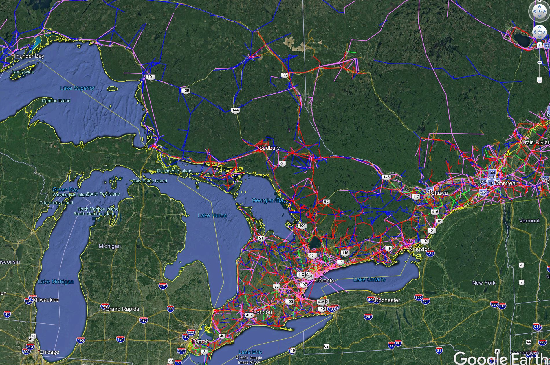
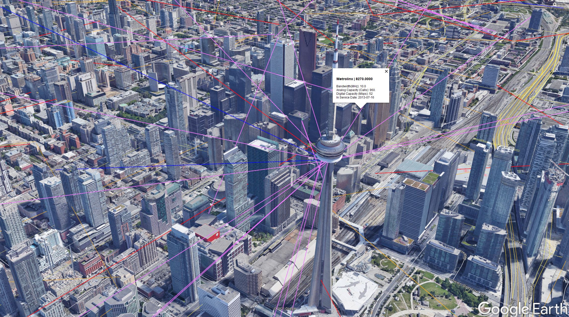
ISED PTP Map
The Canadian government allows the public to browse all registered radio frequency licenses and provides a complete data dump of nearly a million rows of data. I have used this data to make a Google Earth map of all “point to point” wireless links in the country.